

ML163417
People
Contributor
Date
Location
- Age
- Not specified
- Sex
- Not specified
- Playback
- Not specified
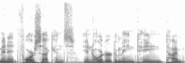
Media notes
Subject 1: (Interview). Subtitle: Claire Parkinson, Elizabeth Arnold. Timecode In: 00:05:37. Timecode out: 00:30:47. Notes: Sea ice discussion. Subject 2: (Sound Effects). Subtitle: Barking dog; walking on snow. Timecode In: 00:31:00. Timecode out: 00:43:44. Equipment Notes: DPA4006 omni mics; Sonosax preamp. NPR/NGS RADIO EXPEDITIONS Show: North Pole Log of DAT #: 3 "Resolute #2 (Spaced Omnis)" Date: 4/25/99 ng = not good ok = okay g = good vg = very good 1:06 sound begins with conversation and preparation to leave 4:58 walking downstairs and onto snow EA 5:32 Who are you? CP 5:33 I'm Claire Parkinson from NASA's Goddard Space Flight Center EA 5:36 And how long have you worked there? CP 5:38 For 20 years. Well, almost 21 years. EA 5:42 And what do you do there? CP 5:43 I'm a scientist. Most of my research has been on sea ice in the Arctic and the Antarctic and most of it has been with satellite images and analyzing satellite data. I'm also the project scientist for a mission that's going up, in terms of being launched, in December of the year 2000. And that mission, that's a satellite mission, so it's got a spacecraft and then it's got six instruments on the spacecraft, and they'll be measuring all sorts of things. Atmospheric temperatures, and humidities, and vegetation on the land, sea ice, snow cover, just a whole stack of, sea surface temperature, all sorts of things regarding Earth's climate, but that doesn't get launched for another year and a half. EA 6:32 How do you learn about what's happening in terms of sea ice from pictures that are taken from satellites? CP 6:38 Okay, there are¿depending on which type of radiation you're using, you can learn a lot of different things. If you're using something like visible radiation, which is the kind of radiation that our eyes see, then you'll see the same type of thing that you would see if you were up in a plane going over the ice cover. So, in other words, you would see what actually looks like an ice float. The problem with that, is just the same as when you're up in a plane and you're looking down, if there's a cloud in the way, you see a cloud instead of the sea ice. Same thing if a satellite's taking data in the visible wavelengths then when there's a cloud in the way, you can't see the data you're looking for at the surface. Course, if you're studying clouds instead, then it's great. But if you're studying something at the surface, whether it's sea ice, or sea surface temperature, or vegetation or whatever, then the visible radiation has that limitation of the clouds get in the way and the other main limitation would be that if it's dark out, you can't get your data, just like your eyes can't see if it's dark out, that the satellite's looking in the same wavelengths that our eyes see, visible wavelengths, that you can't get your data if it's dark out. And so, for that reason, especially in the polar region, when it's dark for months at a time, for that reason, most of the research that I've done and a lot of others who have used satellite data for sea ice have done, does not use visible radiation. Instead it uses microwave radiation, 'cause microwaves, it turns out, microwaves pretty much go straight through the clouds, and when you're using microwave radiation for an Earth-observing satellite, it's radiation that is actually emitted by the Earth and the Earth's surface, so it doesn't require sunlight. So, if it's dark out it doesn't matter, because we're really measuring the radiation that sea ice is emitting and that the ocean is emitting and we're able to tell where the sea ice is because it turns out in microwave wavelengths, in lot of the microwave wavelengths, sea ice ends up emitting a lot more than ocean, than open, you know, liquid water does. So, the ice emits more than the water, and as a... (Notes truncated)
Technical information
- Recorder
- Microphone
- Accessories
Archival information
- Cataloged
- 28 Jul 2010 - David McCartt
- Digitized
- 28 Jul 2010 - David McCartt
- Edited
- 28 Jul 2010 - David McCartt